Living here
What the official statistics say about safety here
The short answer
Recorded crime in the Autonomous Region of Madeira has run below the national rate in every year checked: INE puts the regional rate at roughly three-quarters of the national one for 2025. Natural hazards are the larger published risk, and the regional civil protection plan rates flash flooding in the ribeiras most severe.
Recorded crimes, Autonomous Region of Madeira, 2025
6,630 participations
RASI 2025, 'Participações registadas por distrito e região autónoma'. INE's independent series gives the identical figure.
Sistema de Segurança Interna, 2025 · check it · read August 26, 2026Recorded crimes, Portugal, 2025
365,802 participations
Sistema de Segurança Interna, 2025 · check it · read August 26, 2026Change in recorded crime, Madeira, 2024 to 2025
-3.6%
From 6,877 in 2024.
Sistema de Segurança Interna, 2025 · check it · read August 26, 2026Change in recorded crime, Portugal, 2024 to 2025
+3.1%
Sistema de Segurança Interna, 2025 · check it · read August 26, 2026Crime rate, Madeira, 2025
24.9 per 1,000 inhabitants
INE indicator 0012260, 'Taxa de criminalidade (‰)'. Indicator last updated 26 June 2026.
INE (Instituto Nacional de Estatística), 2025 · check it · read August 26, 202636 more sourced figures on this page
Crime rate, Azores, 2025
35.7 per 1,000 inhabitants
Included because the two autonomous regions are routinely lumped together and are not alike on this measure.
INE, 2025 · check it · read August 26, 2026Violent and serious crime, Madeira, 2025
212 offences
RASI Madeira annex. The ten-year series runs 205 (2016), 269 (2022), 221 (2023), 211 (2024), 212 (2025).
Sistema de Segurança Interna, 2025 · check it · read August 26, 2026Recorded crimes, município do Funchal, 2025
3,196 participations
RASI Madeira annex, municipal breakdown. The eleven municipalities plus an 'unknown' category sum exactly to the regional total.
Sistema de Segurança Interna, 2025 · check it · read August 26, 2026Highest municipal crime rate in Madeira, 2025 (Porto Santo)
31.1 per 1,000 residents
Still below the national rate. The denominator counts residents only and excludes a large seasonal visitor population.
INE, 2025 · check it · read August 26, 2026Lowest municipal crime rate in Madeira, 2025 (São Vicente)
14.3 per 1,000 residents
INE, 2025 · check it · read August 26, 2026Crime rate, Madeira, 2024 — as published by DREM
26.5 per 1,000
DREM (Direção Regional de Estatística da Madeira), 2024 · check it · read August 26, 2026Crime rate, Portugal, 2024 — as published by DREM
33.0 per 1,000
DREM, 2024 · check it · read August 26, 2026Crime rate, Madeira, 2024 — as published by INE
26.0 per 1,000
Same crime count as DREM (6,877). The difference is the resident-population denominator, which INE revised upwards after DREM published.
INE, 2024 · check it · read August 26, 2026Crime rate, Portugal, 2024 — as published by INE
31.2 per 1,000
INE, 2024 · check it · read August 26, 2026Completed voluntary homicides, Portugal, 2025
98
The corresponding Madeira cell in the same INE table carries a suppression marker instead of a value.
INE, 2025 · check it · read August 26, 2026Smallest violent-crime category listed in RASI's Madeira annex, 2025
8 offences
Sexual extortion. Categories below this are not itemised, which is why the regional homicide count cannot be read off the annex either.
Sistema de Segurança Interna, 2025 · check it · read August 26, 2026Registered victims of domestic violence against a spouse or equivalent, Madeira, 2024
1,000 people
DREM, 2024 · check it · read August 26, 2026Change in registered domestic violence victims, Madeira, 2023 to 2024
115
Down from 1,115 in 2023.
DREM, 2024 · check it · read August 26, 2026Share of domestic violence victims who were women, Madeira, 2024
73.2%
DREM, 2024 · check it · read August 26, 2026Deaths in the 20 February 2010 floods — European Commission
42 people
European Commission, 20 February 2010 · check it · read August 26, 2026Deaths in the 20 February 2010 floods — Madeira regional government
48 mortos
Published in the regional gazette as part of the annex to Resolução n.º 805/2017, the first-cycle flood risk management plan. The same table records 250 injured, 600 displaced and 800 dwellings damaged.
Jornal Oficial da Região Autónoma da Madeira, 20 February 2010 · check it · read August 26, 2026Reported death toll, 20 February 2010
42 to 48
Two official sources, no official reconciliation. The commonly offered explanation, confirmed dead plus missing, could not be sourced to any official document and is not asserted.
European Commission / Jornal Oficial da Região Autónoma da Madeira, 20 February 2010 · check it · read August 26, 2026Bridges damaged, February 2010
153 bridges
European Commission, 20 February 2010 · check it · read August 26, 2026Houses destroyed or severely damaged, February 2010
400 houses
European Commission, 20 February 2010 · check it · read August 26, 2026Total direct damage, February 2010, as estimated by the Portuguese authorities
€1,080,000,000
The direct damage figure for the 20 February 2010 floods. The European Union Solidarity Fund grant published on this page is 2.9% of it.
European Commission, 20 February 2010 · check it · read August 26, 2026EU Solidarity Fund grant awarded
€31,255,790
European Commission, 2010 · check it · read August 26, 2026Areas of significant potential flood risk, Madeira, 2022-2027 cycle
63 areas
Jornal Oficial da Região Autónoma da Madeira, 2022-2027 · check it · read August 26, 2026Flood-risk areas of fluvial origin
29 areas
Jornal Oficial da Região Autónoma da Madeira, 2022-2027 · check it · read August 26, 2026Flood-risk areas of coastal origin
34 areas
Jornal Oficial da Região Autónoma da Madeira, 2022-2027 · check it · read August 26, 2026Flood-risk areas identified in the first cycle
27 areas
Named identically in two independent official documents: the 2024 regional civil protection plan and Resolução n.º 805/2017.
Jornal Oficial da Região Autónoma da Madeira, 2016-2021 · check it · read August 26, 2026Resident density inside the 100-year inundation area, Ribeira Brava
1,523 residents per km²
Jornal Oficial da Região Autónoma da Madeira, 2022-2027 · check it · read August 26, 2026Resident density inside the 100-year inundation area, Machico
1,017 residents per km²
Jornal Oficial da Região Autónoma da Madeira, 2022-2027 · check it · read August 26, 2026Resident density inside the 100-year inundation area, Funchal
111 residents per km²
Jornal Oficial da Região Autónoma da Madeira, 2022-2027 · check it · read August 26, 2026Wildfires, Autonomous Region of Madeira, 2024
38 fires
IFCN series published through DREM. ICNF's national statistics exclude Madeira entirely.
DREM / IFCN, IP-RAM, 2024 · check it · read August 26, 2026Area burnt, Madeira, 2024
5,190 hectares
Published as 5 190,38 ha, spread across every fire counted on this page.
DREM / IFCN, IP-RAM, 2024 · check it · read August 26, 2026Of which scrubland, 2024
3,495 hectares
67.3% of the burnt area.
DREM / IFCN, IP-RAM, 2024 · check it · read August 26, 2026Area burnt in Ribeira Brava, 2024
2,509 hectares
48.3% of the regional total. Ribeira Brava also accounted for 19 of the fires counted on this page.
DREM / IFCN, IP-RAM, 2024 · check it · read August 26, 2026Area burnt, Madeira, 2016
6,270 hectares
From 54 fires. Published as 6 270,35 ha.
DREM / IFCN, IP-RAM, 2016 · check it · read August 26, 2026Area burnt, Madeira, 2010
8,632 hectares
From 102 fires, the largest in the published series.
DREM / IFCN, IP-RAM, 2010 · check it · read August 26, 2026Mapped burnt extent, August 2024 central Madeira fire
5,104.1 hectares
Copernicus EMS activation EMSR748, requested by Portugal's National Command for Relief Operations. A satellite-delineated perimeter from imagery of 26 August 2024, not a field survey. Must not be added to the annual total.
Copernicus Emergency Management Service, August 2024 · check it · read August 26, 2026Reference ground acceleration for Madeira, Eurocode 8 national annex
0.35 m/s²
Every Madeira municipality falls in seismic zone 1.6, the lowest on the Type 1 scale, which runs from 2.5 at zone 1.1. Sourced from the CT 115 final-vote text of the national annex hosted by the Ordem dos Engenheiros Técnicos; the published standard is sold by IPQ and is not freely available, so the host is a professional body rather than a government domain. The value is fixed by the National Annex to Eurocode 8. The IPQ-published NP EN 1998-1 is a paid standard, but the CT 115 final-vote text of the annex is free, and that is what this figure is read from — Quadro NA.I for the zone, and the archipelago table that puts every Madeiran municipality in the same one. The publisher is named in the sources below.
Ordem dos Engenheiros Técnicos / CT 115 (LNEC) · check it · read August 26, 2026Almost everything written in English about safety in Madeira says it is very safe and stops there. That sentence is probably true and it is entirely unsourced, which makes it worth nothing to somebody deciding where to live.
The regional figures do exist. The Relatório Anual de Segurança Interna reports Madeira as a distinct region, INE publishes a crime rate per thousand inhabitants for it, and the regional civil protection plan ranks natural hazards on probability and severity. This page uses those, states where two official sources disagree, and says which numbers are simply not published.
What the crime figures actually say
The Relatório Anual de Segurança Interna for 2025, published at the end of March 2026, records 6,630 participations, source: Sistema de Segurança Interna, 2025, read August 26, 2026 in the Autonomous Region of Madeira against 365,802 participations, source: Sistema de Segurança Interna, 2025, read August 26, 2026 nationally. The regional total fell -3.6%, source: Sistema de Segurança Interna, 2025, read August 26, 2026 on the year while the national total rose +3.1%, source: Sistema de Segurança Interna, 2025, read August 26, 2026 — a divergence the report itself notes, remarking on the falls in the autonomous regions.
Absolute counts are not comparable across populations, and RASI does not convert them. INE does. Its crime-rate indicator puts the Region at 24.9 per 1,000 inhabitants, source: INE (Instituto Nacional de Estatística), 2025, read August 26, 2026 against 32.0 per 1,000 inhabitants, source: INE, 2025, read August 26, 2026 for Portugal and 35.7 per 1,000 inhabitants, source: INE, 2025, read August 26, 2026 for the Azores. Madeira holds roughly a fortieth of the country's population and accounts for a smaller share than that of its recorded crime.
Violent crime is a small and flat fraction
RASI's Madeira annex separates violent and serious crime from the general total. It came to 212 offences, source: Sistema de Segurança Interna, 2025, read August 26, 2026 of the 6,630 participations, source: Sistema de Segurança Interna, 2025, read August 26, 2026 recorded in 2025, and the ten-year series in the same annex shows it moving within a narrow band since 2016 rather than trending. The largest single categories were street robbery and bag-snatching, in the dozens rather than the hundreds.
It is concentrated where the people are
Funchal accounts for 3,196 participations, source: Sistema de Segurança Interna, 2025, read August 26, 2026, roughly half the regional total, which tracks its share of the population. On INE's municipal rates every municipality in the Region sits below the national rate, from 31.1 per 1,000 residents, source: INE, 2025, read August 26, 2026 in Porto Santo at the top to 14.3 per 1,000 residents, source: INE, 2025, read August 26, 2026 in São Vicente at the bottom.
That Porto Santo figure needs a caveat rather than a headline. The rate divides crimes by resident population, and Porto Santo has a very small resident base and a large seasonal visitor population that the denominator ignores. The same distortion applies in a milder form to Funchal. A tourist municipality will always look worse on a per-resident rate than it is.
Two arms of the state publish different rates for the same year
This is the sort of thing that usually gets tidied away, and it should not be.
For 2024, DREM published a Madeira crime rate of 26.5 per 1,000, source: DREM (Direção Regional de Estatística da Madeira), 2024, read August 26, 2026 against a national 33.0 per 1,000, source: DREM, 2024, read August 26, 2026. INE, for the same year, publishes 26.0 per 1,000, source: INE, 2024, read August 26, 2026 against a national 31.2 per 1,000, source: INE, 2024, read August 26, 2026.
The crime counts underlying both are identical — the same regional and national totals appear in RASI, in INE and in DREM's release. What differs is the denominator. INE's series is internally consistent on a revised, larger resident population published after DREM's release. So the two figures are not a contradiction in the data; they are the same crimes divided by two different population estimates, one of which is newer.
The consequence for a reader is simple and worth stating: the direction holds and the decimal does not. Madeira sits meaningfully below the national rate on either source. Anyone quoting one of these rates to two decimal places, without saying which body produced it, does not know which number they are holding.
What is not measured, and cannot be inferred
Three gaps matter more than most of what is published.
Madeira's homicide count is withheld
In INE's 2025 table the cell for completed voluntary homicide in Madeira contains a suppression marker rather than a number, where the national figure is 98, source: INE, 2025, read August 26, 2026. RASI's Madeira annex lists only the six most frequent violent crime categories, the smallest of which stands at 8 offences, source: Sistema de Segurança Interna, 2025, read August 26, 2026. The regional homicide count is therefore below that figure and is otherwise not published. This page does not give one.
Crime against visitors is not measured anywhere
RASI discusses pickpocketing as a phenomenon associated with large urban centres and tourist destinations, but reports it only by district, with no Madeira breakdown. INE's victim indicators disaggregate by sex and offence category only — there is no nationality field, no residency field and no visitor flag, and they count victims in tried cases rather than recorded crimes.
So no honest statement can be made about what share of crime here is committed against visitors, in either direction. Any page that gives one has invented it.
Domestic violence is the exception that is measured
DREM reports that police in the Region identified 1,000 people, source: DREM, 2024, read August 26, 2026 of domestic violence against a spouse or equivalent in 2024, 115, source: DREM, 2024, read August 26, 2026 fewer than the year before, of whom 73.2%, source: DREM, 2024, read August 26, 2026 were women. It is the one category with a clear regional series, and it is larger than the entire violent-crime total for the same period, which is a comment on how the two are counted rather than a paradox.
The hazard the Region itself rates most severe
The Plano Regional de Emergência de Proteção Civil, third revision, in force since July 2024, carries a risk matrix scoring each hazard on probability and severity. Flash flooding in the ribeiras is the only natural hazard to receive the highest severity rating alongside windstorms. Landslides, rural wildfire and coastal overtopping carry the highest probability rating at a lower severity. Earthquake is rated medium probability at high severity. Volcanic activity sits at the bottom on both.
The regional flood plan describes the mechanism in its own words: flooding here comes mostly from rapid floods produced by episodes of very intense rainfall on small catchments with short concentration times, giving a torrential regime, sometimes devastating, frequently carrying a heavy solid load. That last clause is the important one, and it is why the local word for the event is aluvião rather than flood.
20 February 2010, and a death toll that depends on which government is asked
The European Commission, awarding Solidarity Fund assistance, recorded 42 people, source: European Commission, 20 February 2010, read August 26, 2026. The Madeira regional government's own table, published in the regional gazette as part of the first flood-risk management plan, records 48 mortos, source: Jornal Oficial da Região Autónoma da Madeira, 20 February 2010, read August 26, 2026.
Both are official. Neither is a press figure. The reconciliation usually offered, confirmed dead plus missing, is arithmetically plausible and could not be sourced to any official document, so it is not asserted here. The honest answer is that the toll is 42 to 48, source: European Commission / Jornal Oficial da Região Autónoma da Madeira, 20 February 2010, read August 26, 2026 depending on which official source is read.
The Commission's assessment also records 153 bridges, source: European Commission, 20 February 2010, read August 26, 2026 damaged and 400 houses, source: European Commission, 20 February 2010, read August 26, 2026 destroyed or severely damaged, with total direct damage put by the Portuguese authorities at €1,080,000,000, source: European Commission, 20 February 2010, read August 26, 2026 and Solidarity Fund assistance of €31,255,790, source: European Commission, 2010, read August 26, 2026.
Where the risk is mapped now
The current plan, covering 2022 to 2027, identifies 63 areas, source: Jornal Oficial da Região Autónoma da Madeira, 2022-2027, read August 26, 2026 in the Region, 29 areas, source: Jornal Oficial da Região Autónoma da Madeira, 2022-2027, read August 26, 2026 of them fluvial and 34 areas, source: Jornal Oficial da Região Autónoma da Madeira, 2022-2027, read August 26, 2026 coastal. The first cycle had identified 27 areas, source: Jornal Oficial da Região Autónoma da Madeira, 2016-2021, read August 26, 2026. The named first-cycle watercourses run through the middle of the populated south: the Ribeiras de João Gomes, Santa Luzia and São João in Funchal, the Ribeira dos Socorridos between Funchal and Câmara de Lobos, the Ribeira Brava, the Ribeira de Machico and the Ribeira do Porto Novo among them.
The plan also publishes resident density inside the hundred-year inundation area, which is the number that turns a map into a property question. Ribeira Brava records 1,523 residents per km², source: Jornal Oficial da Região Autónoma da Madeira, 2022-2027, read August 26, 2026 and Machico 1,017 residents per km², source: Jornal Oficial da Região Autónoma da Madeira, 2022-2027, read August 26, 2026, against 111 residents per km², source: Jornal Oficial da Região Autónoma da Madeira, 2022-2027, read August 26, 2026 in Funchal. The exposure is not evenly spread, and it is highest in two towns people move to precisely because they are not Funchal, a point that belongs alongside the comparison of places to live and how a purchase actually runs.
Landslides, and why they are the same event
The regional flood plan is explicit that these are not two hazards. An aluvião is torrential flow carrying a heavy load, much of it derived from mass movement on the slopes flanking the watercourse, and the trigger for both the flow and the slope failure is the same: a large quantity of rain in a short time.
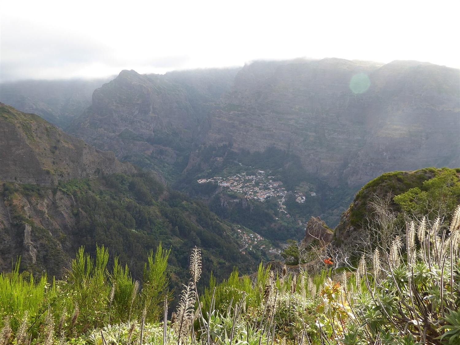
The civil protection plan maps susceptibility rather than frequency. High susceptibility appears across much of the island, concentrated in the centre — the plan names the parishes of Curral das Freiras, Serra de Água and Ponta do Sol, where the steepest slopes coincide. Smaller high-susceptibility areas run along the coast where there are cliffs, at Ponta do Pargo and Achadas da Cruz, and north of Santana and Machico. Moderate susceptibility is widespread, with the urbanised lowlands of Funchal, Santa Cruz, Machico, Santana and São Vicente, the Paúl da Serra plateau and Porto Santo mostly in the low class.
What the official material does not contain is a count. Susceptibility mapping answers where, not how often or how many people. No official count of rockfall incidents or rockfall casualties in Madeira could be found, so none is given, and any specific figure circulating elsewhere has come from press coverage rather than from a record.
Wildfire, and the national statistics that leave Madeira out
This is the single most consequential trap on the subject. ICNF's national wildfire statistics, the figures quoted whenever Portugal burns, cover Portugal Continental and exclude Madeira entirely. The workbook's own sheet names say so, its district breakdown contains only the eighteen mainland districts, and its reports are titled accordingly. A national burnt-area figure for Portugal has never included this island.
Madeira's own series comes from IFCN through DREM. For 2024 it records 38 fires, source: DREM / IFCN, IP-RAM, 2024, read August 26, 2026 burning 5,190 hectares, source: DREM / IFCN, IP-RAM, 2024, read August 26, 2026, of which 3,495 hectares, source: DREM / IFCN, IP-RAM, 2024, read August 26, 2026 was scrubland. Fires occurred in nine of the eleven municipalities; Funchal and Santana recorded none. Ribeira Brava was worst affected with 2,509 hectares, source: DREM / IFCN, IP-RAM, 2024, read August 26, 2026, close to half the regional total.
The longer series is extremely uneven, which is the honest shape of wildfire risk here. A handful of years dominate: 6,270 hectares, source: DREM / IFCN, IP-RAM, 2016, read August 26, 2026 in 2016 and 8,632 hectares, source: DREM / IFCN, IP-RAM, 2010, read August 26, 2026 in 2010, against years in the same decade that recorded under a hundred hectares in total. Annual averages on this data mislead badly.
The August 2024 fire
Copernicus Emergency Management Service was activated by Portugal's national civil protection command and mapped the burnt extent at 5,104.1 hectares, source: Copernicus Emergency Management Service, August 2024, read August 26, 2026, delineated from satellite imagery at the end of August 2024. That figure and the 5,190 hectares, source: DREM / IFCN, IP-RAM, 2024, read August 26, 2026 annual total above are close for the obvious reason, one event dominated the year, but they measure different things and must never be added together.
Daily fire risk for the island is published by IPMA on a separate product from the mainland one, as a Fire Weather Index map for the archipelago rather than the mainland's per-municipality index. IFCN links to that page as its own operational source.
Earthquake, sea, and the rest
Madeira sits in the lowest seismic zone in the Portuguese national annex to Eurocode 8. Every municipality in the Region falls in zone 1.6, with a reference ground acceleration of 0.35 m/s², source: Ordem dos Engenheiros Técnicos / CT 115 (LNEC), read August 26, 2026, and the annex provides that only Type 1 seismic action need be considered for the archipelago. The scale's highest Type 1 zone carries several times that acceleration. The regional civil protection plan independently rates earthquake as medium probability with high severity, which is the correct combination for a low-frequency, high-consequence hazard rather than a contradiction of the zoning.
At sea, IPMA issues warnings across four separate Madeira areas, north coast, mountain, south coast and Porto Santo, including a coastal-event warning type alongside rain, wind, thunderstorm, temperature and fog. Coastal flooding is a designated risk in its own right: 34 areas, source: Jornal Oficial da Região Autónoma da Madeira, 2022-2027, read August 26, 2026 of the Region's flood-risk areas are coastal rather than fluvial, taking in the Lido and Ponta Gorda in Funchal, Câmara de Lobos, Machico, Porto Santo, and the seafronts at Jardim do Mar and Paúl do Mar.
Coastal erosion is rated medium probability at residual severity, and volcanic activity low probability at residual severity. Neither is a live planning concern in the official documents, and neither is treated as one here.
The one thing this page cannot substitute for is proximity to emergency care, which is a different question and is set out in how the regional health service is distributed across the island.
Questions people actually ask
Is Madeira safe?
On the published statistics, safer than Portugal as a whole. INE puts the regional crime rate at 24.9 per 1,000 inhabitants, source: INE (Instituto Nacional de Estatística), 2025, read August 26, 2026 for 2025 against 32.0 per 1,000 inhabitants, source: INE, 2025, read August 26, 2026 nationally, and violent crime came to 212 offences, source: Sistema de Segurança Interna, 2025, read August 26, 2026 out of 6,630 participations, source: Sistema de Segurança Interna, 2025, read August 26, 2026 recorded offences. Natural hazards, not crime, are what the regional civil protection plan treats as the serious risk.
What is the crime rate in Madeira compared with mainland Portugal?
Roughly three-quarters of it. INE gives 24.9 per 1,000 inhabitants, source: INE (Instituto Nacional de Estatística), 2025, read August 26, 2026 for the Region against 32.0 per 1,000 inhabitants, source: INE, 2025, read August 26, 2026 for Portugal in 2025, and the Azores at 35.7 per 1,000 inhabitants, source: INE, 2025, read August 26, 2026. Note that DREM and INE publish different rates for 2024 from identical crime counts, because INE later revised the population denominator upwards.
How many murders are there in Madeira?
Not published. INE's 2025 table carries a suppression marker in the Madeira homicide cell where the national figure is 98, source: INE, 2025, read August 26, 2026. RASI's regional annex itemises only the six commonest violent offences, the smallest at 8 offences, source: Sistema de Segurança Interna, 2025, read August 26, 2026, so the count is below that and otherwise unknown. Any specific figure quoted elsewhere is not from these sources.
Is Madeira at risk of flooding?
Yes, and the Region rates it the most severe natural hazard it faces. The current flood plan designates 63 areas, source: Jornal Oficial da Região Autónoma da Madeira, 2022-2027, read August 26, 2026 of significant potential flood risk. The February 2010 event killed 42 to 48, source: European Commission / Jornal Oficial da Região Autónoma da Madeira, 20 February 2010, read August 26, 2026 depending on the official source, damaged 153 bridges, source: European Commission, 20 February 2010, read August 26, 2026 and caused €1,080,000,000, source: European Commission, 20 February 2010, read August 26, 2026 of direct damage.
Do Portugal's national wildfire statistics include Madeira?
No. ICNF's series covers Portugal Continental and excludes the archipelago, its own sheet names and district breakdowns confirm it. Madeira's figures come from IFCN through DREM: 38 fires, source: DREM / IFCN, IP-RAM, 2024, read August 26, 2026 burning 5,190 hectares, source: DREM / IFCN, IP-RAM, 2024, read August 26, 2026 in 2024, with the August event alone mapped by Copernicus at 5,104.1 hectares, source: Copernicus Emergency Management Service, August 2024, read August 26, 2026.
Do earthquakes affect Madeira?
The archipelago sits in the lowest seismic zone in the Portuguese national annex to Eurocode 8, at a reference ground acceleration of 0.35 m/s², source: Ordem dos Engenheiros Técnicos / CT 115 (LNEC), read August 26, 2026, and only Type 1 seismic action need be considered. The regional civil protection plan still rates earthquake medium probability with high severity, which is the standard treatment of a rare, high-consequence hazard.
Where this came from
- Sistema de Segurança Interna: Relatório Anual de Segurança Interna 2025. ssi.gov.pt/publicacoes/rasi/RASI2025.pdf Read August 26, 2026.
- Sistema de Segurança Interna: Relatório Anual de Segurança Interna 2024. ssi.gov.pt/publicacoes/relatorio-anual-de-seguranca- Read August 26, 2026.
- INE: Taxa de criminalidade (‰) por localização geográfica — indicador 0012260. ine.pt/xportal/xmain Read August 26, 2026.
- INE: Crimes registados pelas autoridades policiais — indicador 0012261. ine.pt/xportal/xmain Read August 26, 2026.
- DREM: Justiça — comunicado de imprensa, ano de referência 2024. estatistica.madeira.gov.pt/en/download-now-3/social-gb/justice/justi Read August 26, 2026.
- Serviço Regional de Proteção Civil da Madeira: PREPC-RAM — Plano Regional de Emergência de Proteção Civil, 3.ª revisão, 2024. procivmadeira.pt/images/planeamento-de-emergencia/2024/PRE Read August 26, 2026.
- Jornal Oficial da Região Autónoma da Madeira: Resolução do Conselho do Governo Regional n.º 21/2024 — PGRI-RAM 2022-2027. joram.madeira.gov.pt/joram/1serie/Ano%20de%202024/ISerie-013-2 Read August 26, 2026.
- Jornal Oficial da Região Autónoma da Madeira: Resolução n.º 805/2017 — PGRI-RAM 2016-2021. joram.madeira.gov.pt/joram/1serie/Ano%20de%202017/ISerie-187-2 Read August 26, 2026.
- European Commission: EU Solidarity Fund Annual Report 2010, COM(2011) 694 final. eur-lex.europa.eu/legal-content/EN/TXT/HTML/ Read August 26, 2026.
- DREM / IFCN, IP-RAM: Estatísticas regionais do ambiente, ano de referência 2024. estatistica.madeira.gov.pt/download-now/ambiente-territorio/ambente/ Read August 26, 2026.
- Copernicus Emergency Management Service: EMSR748 — Wildfire in Central Madeira, Portugal. mapping.emergency.copernicus.eu/activations/EMSR748/ Read August 26, 2026.
- IPMA: Índice Meteorológico de Incêndio (FWI) — Arquipélago da Madeira. ipma.pt/pt/riscoincendio/rcm.md/ Read August 26, 2026.
- IPMA: Avisos meteorológicos — Arquipélago da Madeira. ipma.pt/en/otempo/prev-sam/ Read August 26, 2026.
- Ordem dos Engenheiros Técnicos / CT 115 (LNEC): NP EN 1998-1, Anexo Nacional — zonamento sísmico. oet.pt/downloads/eventos/EuroCodigo8.pdf Read August 26, 2026.